Bike tours are an increasingly popular pastime. Exercise in the fresh air, beautiful landscapes and exciting sights - and cycling is also environmentally friendly. To make the bike tour a success, there are not only fixed bike sat navs, but also various apps with which you can plan a route on your smartphone and navigate using GPS while you are on the move. In this article we present a selection of navigation apps for bicycles.
Completely free, but limited
Google Maps
The top dog among the navigation apps is basically also suitable for cycling. However, Google Maps often leads you along main roads, good bike paths are ignored. Because Google Maps is not specifically intended for cycling, but a general navigation app. The advantage over most other navigation apps, however, is that Google Maps is completely free.
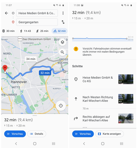 Google Maps is preinstalled on Android phones and also offers route planning for cyclists.
 Rad-Navi Niedersachsen
The Rad-Navi Niedersachsen app is completely free . As the name suggests, however, it is optimized for use in Lower Saxony: offline use is only possible there because the offline map files would otherwise be too large. The address database includes all of Germany , the BeNeLux countries and Austria; You can navigate worldwide with the app . The app calculates a route for you from A to B and then navigates you using text and voice output. You will also find tour suggestions and tips on nearby attractions directly on the map..
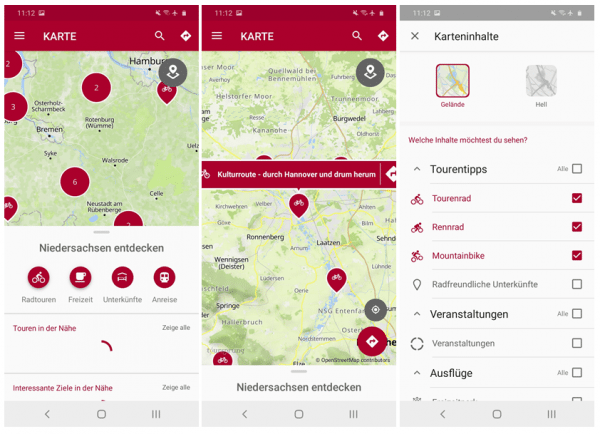 In the Lower Saxony bike navigation system, you can see tips directly on the map: You can use the gray location symbol at the top right to set which map content should be shown.
 Good navigation with in-app purchase and subscription
Most of the navigation apps for cycling are free in the basic version. But you have to buy many functions individually or take out a paid subscription. The offline maps are particularly expensive, but they are extremely helpful to save data volume and smartphone battery and not to lose orientation even with poor network coverage. A selection of these apps follows here.
Probably the best known: Komoot
The Komoot app is probably the most established bicycle app. After you have created an account, you can use it to plan your tours according to various criteria: type of bike (cycling / mountain biking / racing biking), altitude, difficulty, ... The app guides you by voice output. You get the offline map free of charge for one region, you have to purchase additional regions for 3.99 euros each (in the package 8.99 euros) via in-app purchase. Alternatively, you can activate all cards for a one-time fee of 29.99 euros. Plus points at Komoot are the large community with which you can exchange routes, pictures and tips, as well as the menu item "Discover", with which you can find ready-made routes in your area. There is also a premium version of the app for 4.99 euros per month..
 Komoot is probably the best known app for bike navigation with a large community.
 Alternative to Komoot: Bikemap The navigation
app Bikemap works in a similar way to Komoot , here too you need an account to use it (the "skip" button on the start page only leads to the map, you have to log in for all functions). You can search for specific locations or addresses, but also for keywords such as "charging station". Navigation by voice output is even included in the free basic version. On the other hand, you have to pay for offline maps or routes for special types of bicycles. The subscription costs 6.99 euros per month or 34.99 euros per year. In the app, you can record and save your tours, exchange ideas with the community and improve the maps by reporting errors or marking points of interest. Under "Discover" you will find tour suggestions for different target groups.
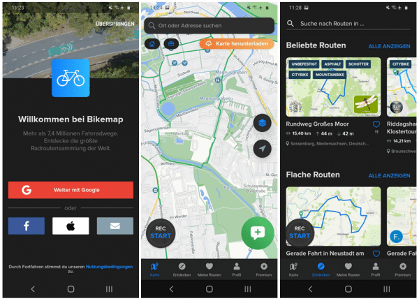 The "skip" button on the homepage is misleading: You need an account to really use Bikemap.
 Works without a user account: Naviki
Another alternative to Komoot is the Naviki app . The account is not required here. Here, too, the basic functions of the app are free of charge, such as basic route planning, setting intermediate destinations and route suggestions. You can also take inspiration from tours offered by the community. With an in-app purchase, you can then filter tours by type of cycling (for example, you can include the ban on S-Pedelecs in route planning), use the app without advertising, activate voice navigation and use individual offline maps.
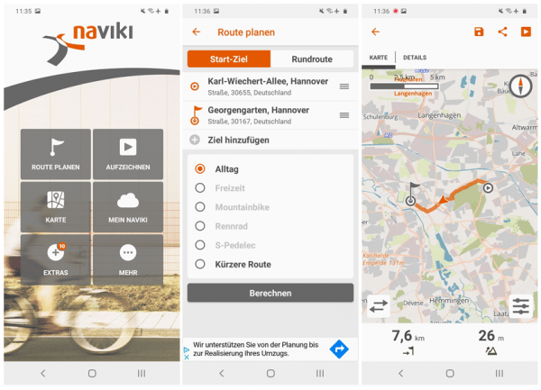 You don't need a user account with Naviki. With an in-app purchase, you can plan a route especially for S-Pedelecs.
 Also for hikers: Outdooractive
The navigation app Outdooractive was originally intended for hiking. Cyclists can now also use them for their tours. There are official tours recommended by cities or tourist regions, for example; the community also exchanges ideas about their favorite tours. With the app you can choose from different map views and of course you can create your own tours, which you can also call up on your desktop. Here, too, there is a paid subscription that unlocks additional functions, including the offline maps. You also need to create a user account for navigation.
 Outdooractive was originally intended for hiking tours - now cyclists can also use the app.
 Navigation in the big city
In the city in particular, it can be helpful to have a bicycle navigation app. After all, who wants to cycle in the noise and fumes of the main road? Some apps therefore specialize in finding the best bike routes in the big city. The Bike Citizens app (formerly BikeCityGuide) is one of them. The app's database includes maps of several German cities with more than 100,000 inhabitants, plus other large cities around the world.
Some cards can even be used offline free of charge, but for most you need to create an account and take out a premium subscription (EUR 3.50 per month or EUR 28 per year). Bike Citizens allows you to avoid main roads and instead ride on beautiful and quiet back roads. An alternative for iOS users is the bbybike app . In addition to the usual navigation, you can use various filters here to bypass traffic lights or cobblestones and avoid unlit streets.
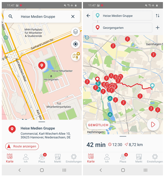 The maps for some cities are sponsored in Bike Citizens and can be used free of charge with all premium functions.