There are lots of apps on the Play Store to help you use public transportation. This is handy especially when you don't know where the nearest stop is. Problem all these applications take up a lot of space. We will see today that it is possible to consult the bus passage times directly on Google Maps..
Android apps for getting around town
Whatever the brand of your smartphone, the amount of usable memory never corresponds to that indicated on the technical sheet of the device. The fault lies in the Android operating system and the applications added by the manufacturers.
For some models, this difference is sometimes very large. It is not uncommon to find commercially available 16 GB phones that actually only offer 10 or 9 GB of memory actually available. It doesn't do much to install its messaging apps, music, videos and videos..
It is therefore necessary to manage the memory of your phone with the greatest attention. Do not hesitate to delete the games that you no longer use or the applications that are not very useful.
Why for example keep an application dedicated to public transport ? Google Maps available by default on Android smartphones already has many functions to help you get around the city with confidence..
Google Maps and public transport
Google’s mapping app is not just about driving. For several months, it has been integrating different modes of transport such as the bus, metro, RER or tram.
You can for example use it to calculate your route or know in real time the time of passage of your bus or metro at the station of your choice. Regulars of public transport will thus be able to know if their bus is late and what time it will arrive. This system is very useful especially in winter. Anyone who has ever waited long minutes in the cold knows what I'm talking about.
Display the bus, tram or metro passage time on your mobile
Google has launched a program allowing transport authorities to integrate various data relating to their activities into Maps, in particular the precious list of bus and metro timetables . Most of the large and medium-sized French cities have decided to join this project.
 The inhabitants of these metropolises can thus consult directly from Google Maps the locations of the lines, define a route and of course take advantage of the crossing times of each line.
- Open the Google Maps app
- Click on the menu button to the left of the search field
- Select the section Public transport
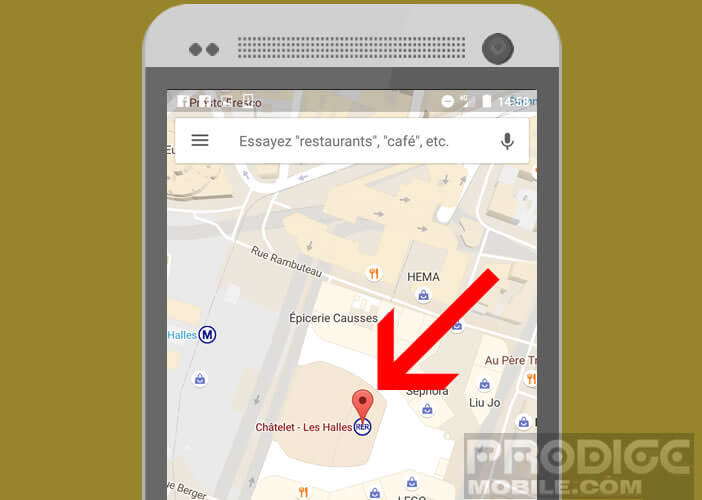
- Click on the my location button so that the mapping application can display your current location on the map
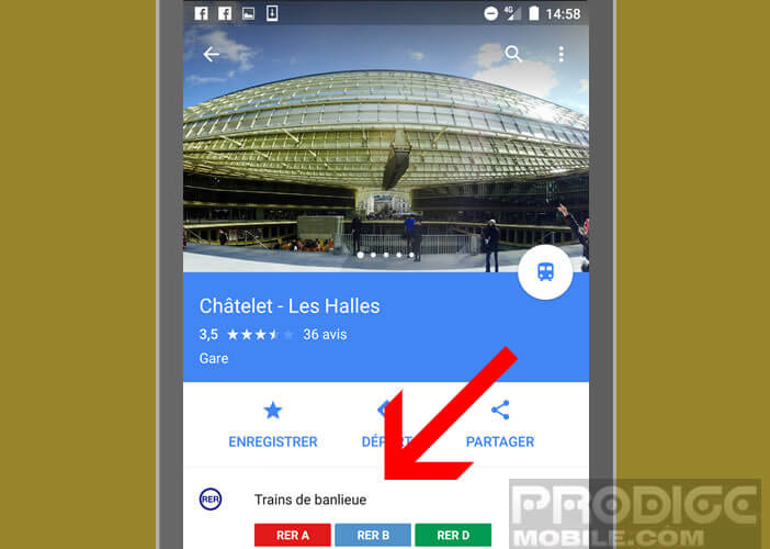
- Then click on the Metro, Bus or RER icon closest to your location
- Place your finger at the bottom of the screen and scroll up the info sheet
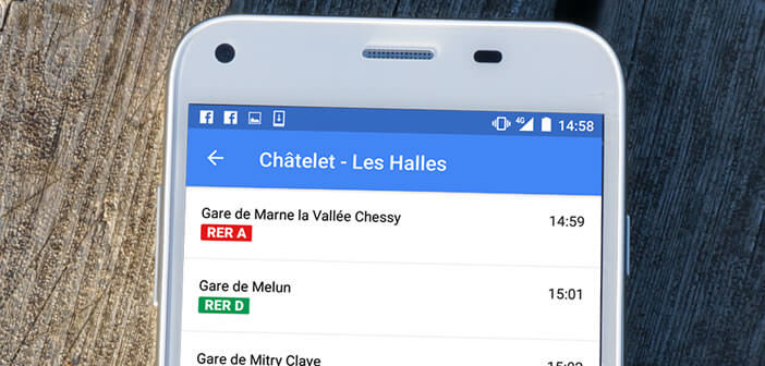
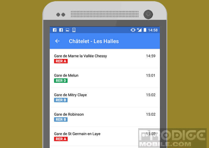
- Then click on the metro or RER line that interests you to display the schedule of next departures from this station.