Using a smartphone in nature is controversial, but there is no doubt that traveling with it is much more relaxed. Even if you are against using your smartphone while on vacation, it would be nice to install a couple of applications from this article on it and hide it in your backpack: at least in case you have any problems with determining your location..
Some apps will make sure you don't get lost, others will automatically send a notification to your loved ones if you don't get to the end of the route at the specified time. Other apps will help you find new routes and points of interest. Charge your battery to 100%, turn on airplane mode and try some of them on your next hike.
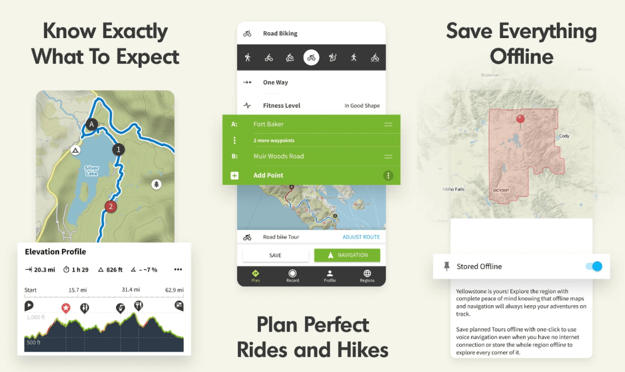
Gaia GPS
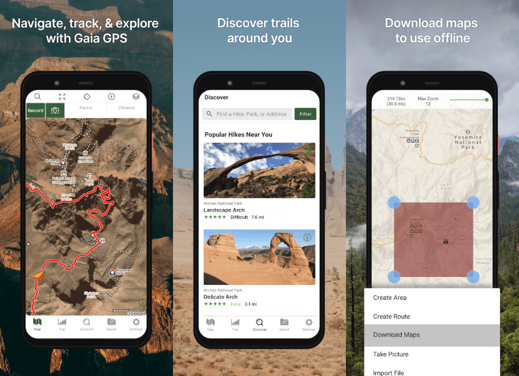
In the free version, you can plan routes, record waypoints and routes, record tracks and keep track of your current location on the map. With a paid subscription, you get access to a variety of maps and layers that can be downloaded for offline use. That being said, Gaia has excellent battery life. With full GPS tracking, iPhone battery consumption is only 2% per hour..
Gaia GPS works in the "cloud" - you can find routes or create your own on your computer, and they will be automatically transferred to the application on your phone. This also works the other way around - any tracks that you record on your phone will be available on your computer. It is possible to export the track to GPX or other formats for computer programs.
A premium subscription allows you to overlay additional maps (such as National Geographic Trails) or cellular coverage to see if you can connect where you are going. Need more information? You will also have access to many other map layers such as weather forecast, snow level, avalanche forecast, coastal ebb and flow, mountain climbing routes, river maps, and more..
Available for iOS and Android .
AllTrails
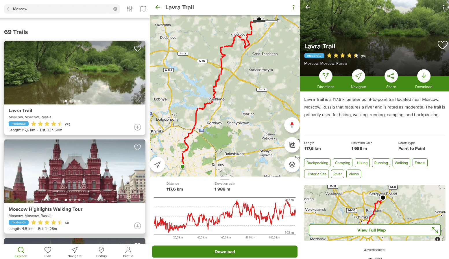
In AllTrails you can find a variety of routes, no matter where you are. Running, cycling and hiking trails are displayed with an indication of their length, difficulty and are provided with photographs from users. If you go astray, it will tell you exactly where you are and how far you have strayed from the route. It also records information such as time, distance and maximum speed.
Perfect for out-of-town walks. While this app is more for those looking for ready-made hiking trails, AllTrails allows you to create your own.
Available for iOS and Android .
what3words
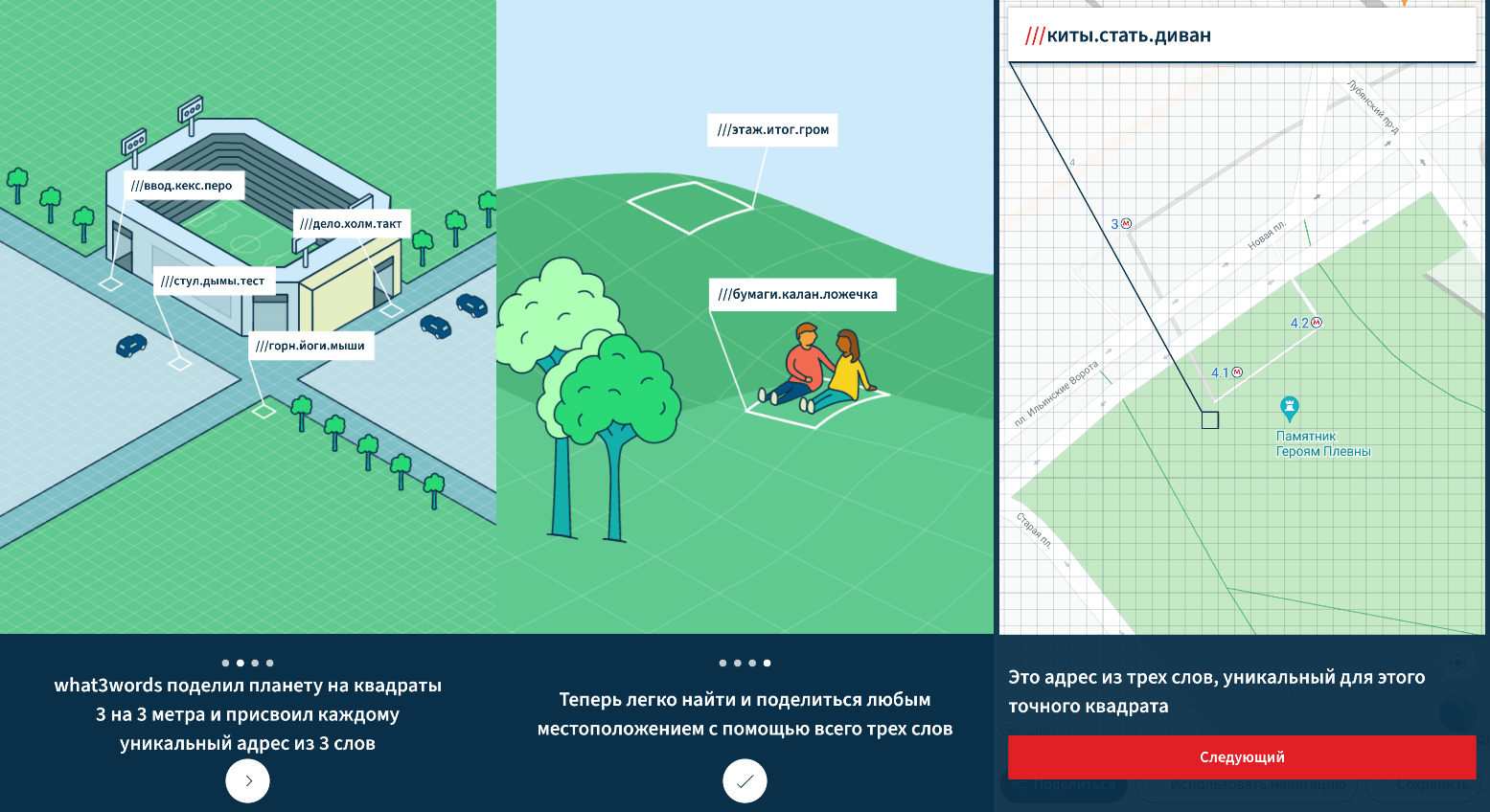
It's certainly not exactly an app to count on when navigating the mountains or crossing the wild jungle, but what3words deserves to be mentioned.
The program was invented by a man who is extremely tired of the fact that couriers cannot find their way to his home located in the countryside of Hertfordshire (England). He developed a system according to which the entire planet was divided into 3x3 meter squares (as a result, 53 trillion squares were obtained), and each of them received a unique identifier consisting of three words.
An amazingly simple idea. It can be used for extremely accurate binding to a location between friends who have no idea what bearing or orientation on a grid of coordinates is. It is also used by publishers of Lovely Planet travel guides (to indicate the location of attractions) and even in some remote parts of Africa and Mongolia, where streets often do not have names.
Available for iPhone and Android .
Viewranger
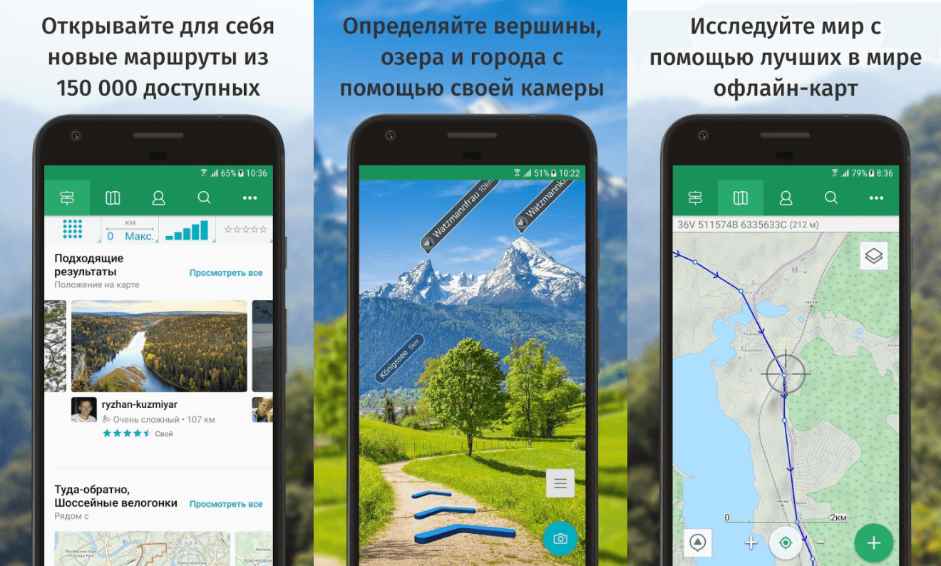
Great for hikes of increased difficulty and long hiking trips. Viewranger can be seen as an alternative to OS Maps. The app offers the same options plus a few additional options that will especially appeal to hikers.
An annual subscription worth 500 rubles opens up the possibility of automatic route building, as well as real-time path tracking and augmented reality elements.
Available for iOS , Android , Apple Watch and Wear OS.
Komoot
The main advantage of Komoot is the minimum effort for planning a trip or hike. After entering the starting and ending point, the application will develop a route along the available roads and trails, similar to how a GPS navigator does in a car. Most of the other applications have this as well, but there is a detailed description of the difficulty level of the route and the features of the terrain.
Available for iPhone , Android , Apple Watch, Samsung Gear, and Garmin.
Cairn
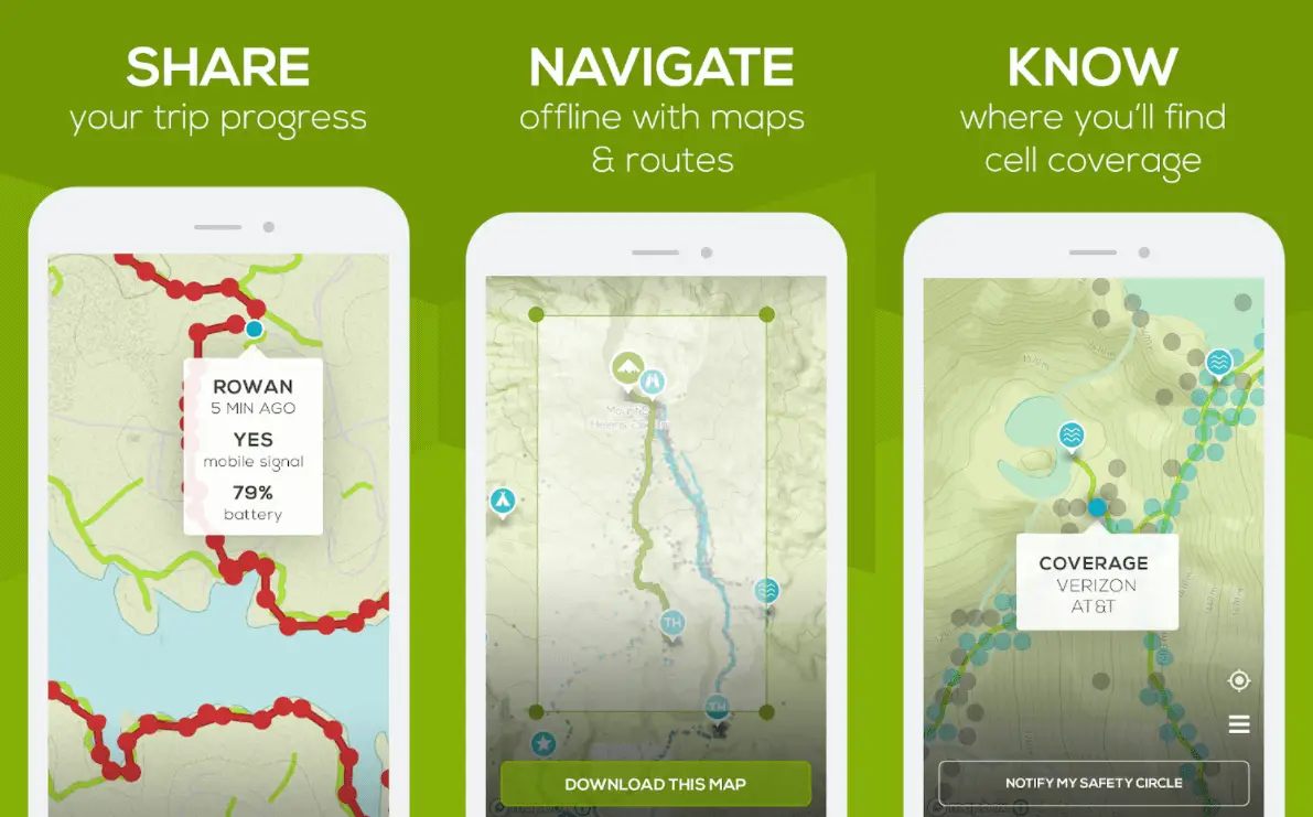
The Cairn app lets you share your planned itinerary with your loved ones before you even start your hike. Thus, if you fail to reach the destination at the specified time, the application will automatically send an alert to your loved ones and report your GPS coordinates.
However, it should be borne in mind that the location update occurs only in areas where there is a cellular connection. The application has a special function that shows where cellular communication will be available on your way. If necessary, you can pre-download up to five maps at the same time to use them without Internet access.
Unfortunately, the app is not free, but there is a one-month trial period.
Available on iOS and Android .
OS Maps
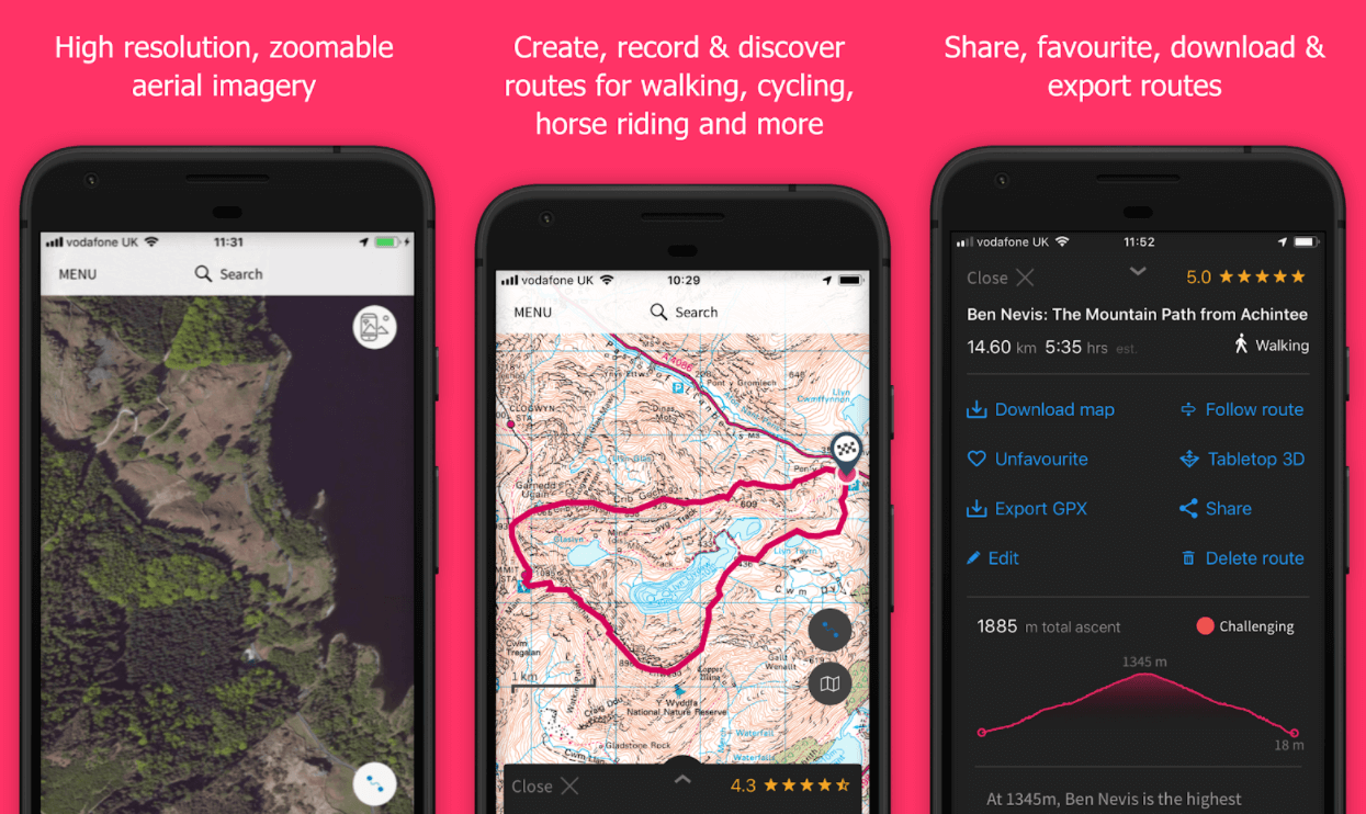
If you find yourself in the UK, then take a look at the app that is great for planning your hikes on this island. It includes all the necessary functionality for hikers. The free version provides the ability to create, print and share links to routes with other users.
The app syncs with the web version, so you can view maps on the big screen, which is much more convenient than fiddling with them on the phone display. Once you have prepared your route, you can follow it using GPS and an arrow will point to your current location.
Purchasing an annual subscription for 3000 rubles gives you access to OS Explorer and OS Landranger maps (local maps), as well as other interesting functions: walks in three-dimensional format, augmented reality that displays the names of hills on the ground and sights encountered.
Available for iPhone and Android .
Maps 3D Pro
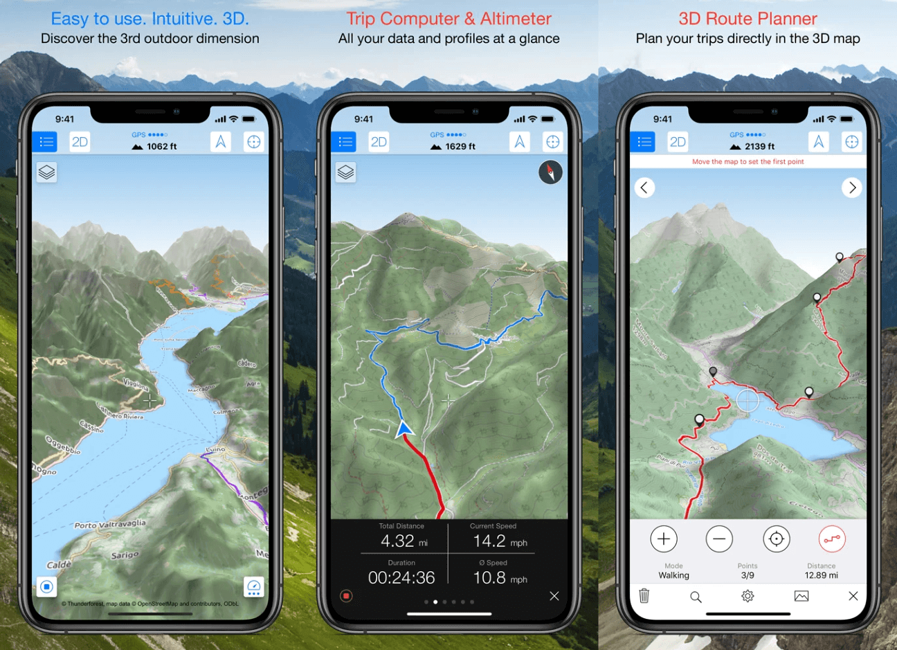
If you find it difficult to read topographic maps, take a look at Maps 3D Pro .
The application displays the terrain in its natural form: there are mountains, hills, valleys. In addition, the maps will show your location, you will know the exact altitude at which you are, how far you have come and how much more to overcome.
It is possible to download maps in order to have access to them without Internet access and add intermediate goals. The application also provides the ability to search for attractions, roads and settlements on the map.
Available for iOS .
MapOut
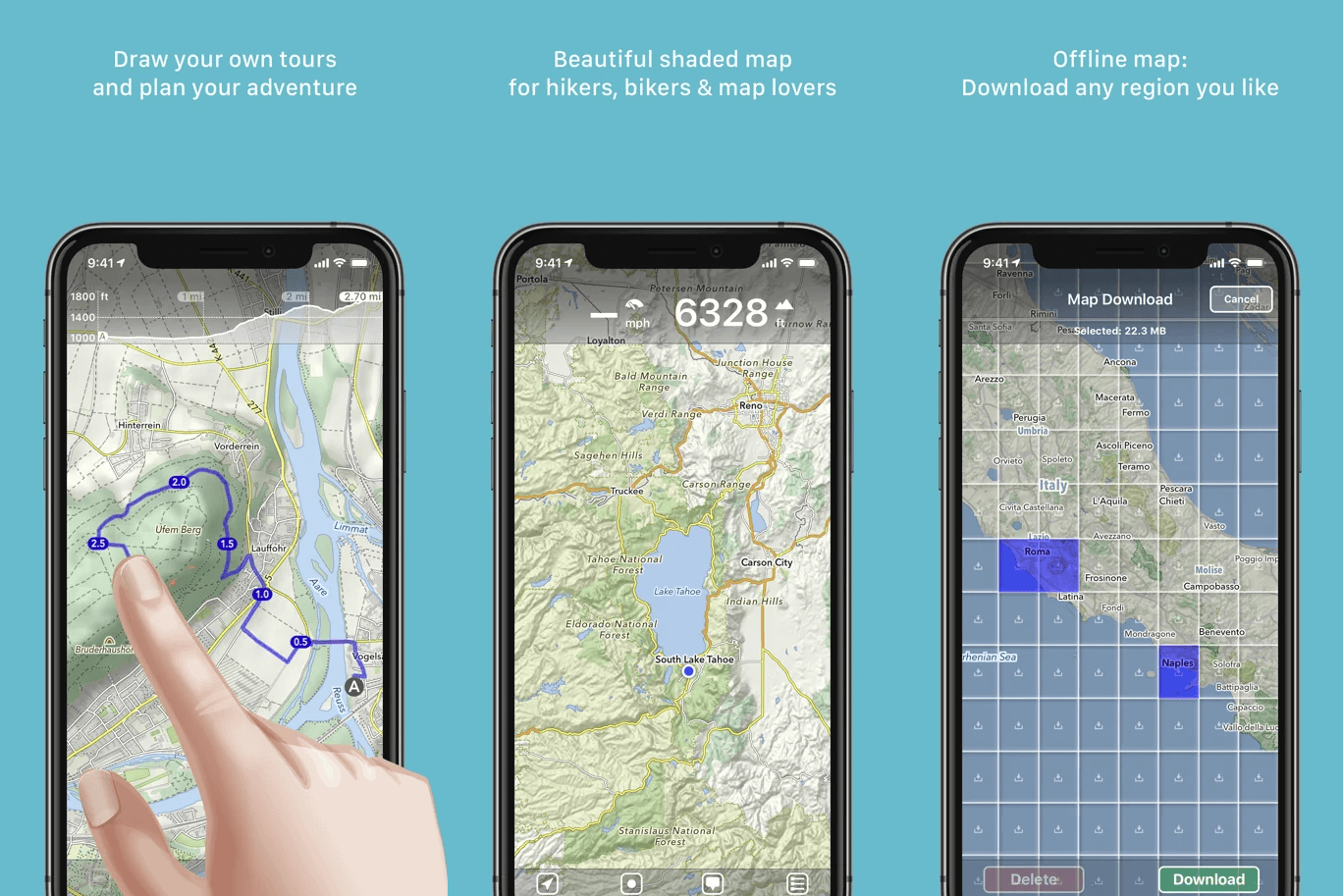
This is a great hike planning app if you want to put in a minimum of effort. The cost of the application is only $ 5, but its interface is better understood than in other applications, which greatly facilitates the laying of the route.
MapOut works with OpenStreetMap maps . They are less detailed than Yandex Maps or Goolge Maps, but great for walking. There is a function for importing and archiving files in gpx format (a standard format for laying pedestrian routes).
Available for iPhone .