From May 11, the government relaxes travel rules. It will be possible to circulate within a radius of 100 km around his home. We offer some tools to calculate and visualize on a map this permission area..
How far you can go from May 11
We are living in an unprecedented period. Containment rules affect our movement and our lives. From May 11, France enters a phase of deconfinement. Travel without a certificate will be authorized again, but limited.
Except in exceptional cases (imperative, family or professional reasons), each citizen is required to circulate within a radius of 100 km around his home. This measure was put in place to reduce the spread of the virus from one region to another..
It is quite difficult to accurately estimate this area. Fortunately, most GPS applications will be able to help you visualize the 100 km perimeter around your home. These are very useful for knowing the virtual borders that should not be crossed. Remember that in case of break-ins you risk a fine.
Determine the perimeter of 100 km around your home
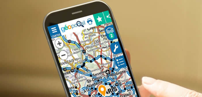
To anticipate the phase of deconfinement, it is better to know where you have the right to go. The Géoportail site published by IGN (The National Institute of Geographic and Forest Information) provides a whole set of tools to calculate the area of 100 km around your home not to be exceeded..
- Open your web browser
- Type the following address in the URL field: https://www.geoportail.gouv.fr/carte
- Click on the cards button at the top left
- Select the IGN Plan option
- Press the cards button again to close the window
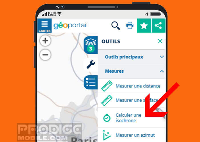
- Then click on the wrench icon
- Select the measurement option then calculate an isochronous
- In the departure field enter your home address
- Click on the isodistance icon
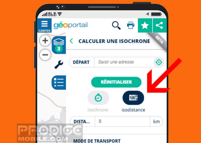
- Enter 100 km in the distance field
- Press the calculate button
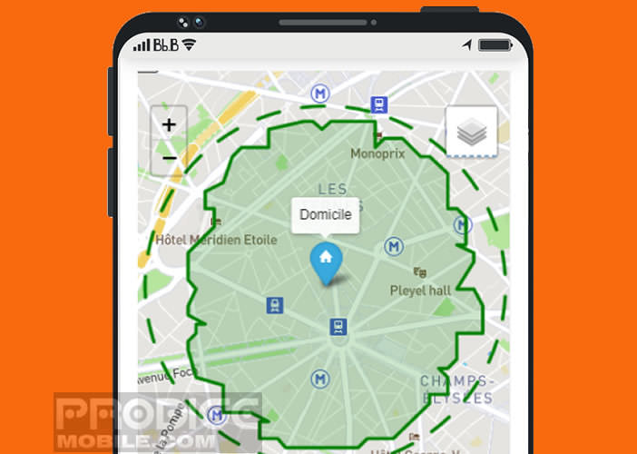
- Right click on the green area
- Then select share the map to keep a permanent link to your containment area
- You can also print the map
The site will show you the area in which you have the right to move. Unlike other applications, the Geoportail site takes into account the real distances traveled passing by the roads and not as the crow flies. This is why the area does not look like a perfectly round circle.
Obviously the information displayed by the site is given as an indication. The objective is to respect the deconfinement instructions and not to go as far as possible. Beyond 100 km, in the event of an inspection, you must present a certificate of derogatory travel to the police.
Although very precise, the Geoportail site sometimes encounters some technical difficulties. The tool must certainly record a large number of connections. In case of high attendance, we advise you to refer to the site https://covidradius.info/ developed by two young Grenoble residents.
 The principle is exactly the same. You enter the address of your home, you click on the button to see if I am within the perimeter. The area is automatically displayed on the map. Note that on the application, the phone starts to vibrate automatically when you leave the demarcated area.