You are in a hurry to get to work. As you climb to the platform, the doors of the electric train close, and the suburban train, gradually picking up speed, rolls to its destination without you. We were only a couple of seconds late, but you will lose 20-30 minutes waiting for the next train..
Fortunately, modern technologies will come to our aid in this matter as well. The article below describes the best public transport tracking applications with which you will never miss a train or bus and will always know how to get from point A to point B, in almost any city and country.
Citymapper
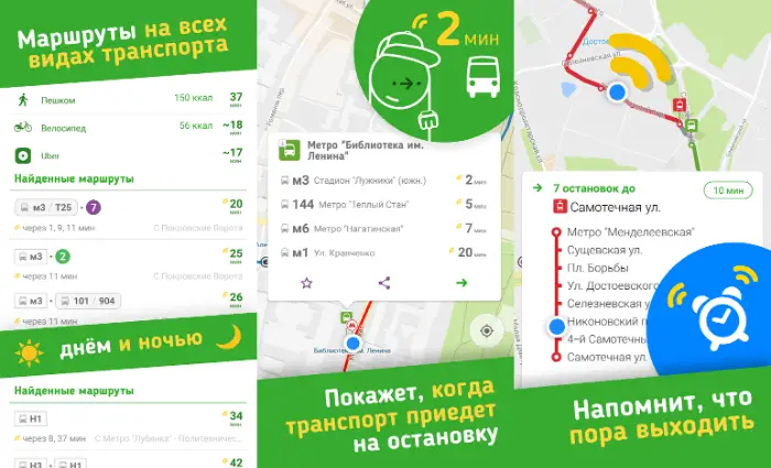
Citymapper will provide complete and up-to-date information on all types of public transport in your city. Need to know the train or bus timetable? Just select the desired item "Trains" or "Buses" in the main menu of the application, respectively. Citymapper will open a map showing all train stations, bus stops and subway stations within walking distance of you..
Select "Get to" from the main menu and enter the location you want to get to. The app itself will compose the optimal route taking into account public transport, show the expected arrival time and even calculate the cost of the trip.
But Citymapper isn't just limited to trains, buses and the subway - the app takes into account ridesharing, taxi services like Uber or Lyfts, bike lanes, and even ferry crossings..
Available for Android / iPhone .
Moovit
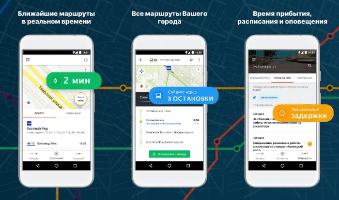
Moovit supports up to 2,700 cities worldwide. When you're ready to hit the road, launch Moovit and follow the app's tips to get to your destination on time.
Choose the most optimal route and move to your destination by bus, train, bicycle, subway train, ferry or even a taxi. The app also supports many transportation services around the world, including MTA, NJ Transit, LA Metro, BART, Caltrain and many more.
Moovit has a simple interface. The application shows only what you need, without cluttering the map with unnecessary information. Select the "Lines" option at the bottom of the screen - you will see the routes of trains and buses. If you tap a certain line, the application will immediately show the corresponding traffic schedule. You can also move the cursor around the map. In this case, the application will show the nearest public transport stops to the sign.
Available for Android / iPhone .
Rome2rio
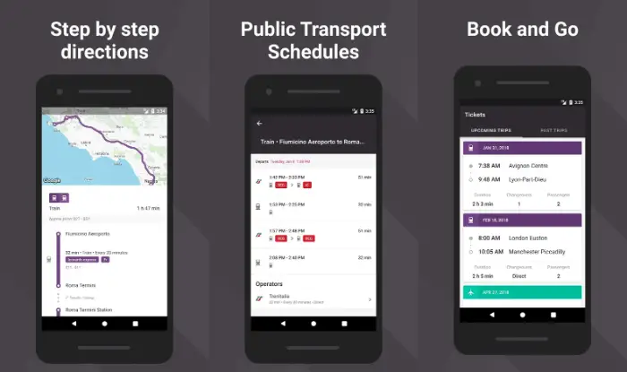
Rome2rio takes into account not only ground transport, including buses, trains and trains, ferries, car rental and ridesharing services, but also air transport. Rome2rio gives the user access to flight schedules and ticket prices of 5,000 different airlines from 160 countries around the world.
Just enter your destination in the Rome2rio search box. And it doesn't matter where you need to get, whether it is the neighboring area of the city or the opposite end of the country, in any case Rome2rio will show you the most convenient way to get from point "A" to point "B". Rome2rio can even book tickets, making it one of the best travel planning apps out there.
Available for Android / iPhone .
Transit

With the Transit app, which has a very simple interface, it's easy to get from point A to point B. As soon as you launch the app, it will show you a map of your area showing the nearest stops and public transport timetables. Good news for US residents and visitors: Unlike Citymapper, Transit supports Amtrak.
You can even track the current position of your bus or train in real time in the app. From now on, you don't have to worry about being late somewhere. Plus, you can turn on pop-up notifications to alert you of changes in timetables and public transport routes. As the developers assure, Transit can show how much a bus or train is full. In which cities this function works is unknown.
If you don't know the area you are in, use the “Go” option to enable turn-by-turn directions for your route. In this case, you will definitely not go wrong either with a bus stop or with a railway station, and you will definitely get to your destination on time.
Don't have a suitable public transport? The app lets you call a Lyft, Uber, or Via taxi, get directions on foot, or find the nearest bike rental shop.
Available for Android / iPhone .
Transportr
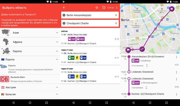
When it comes to public transport, there is no one more knowledgeable than the locals. This is where Transportr comes in, an open source application and information system developed by a community of users from all over the world. You can even add your own city to the app if it isn't already there.
Ready to hit the road? Type in your destination, and Transportr will immediately show you the best routes including metro, trains and buses, as well as departure times, stops and delays for various reasons. On the map you can find the stops closest to you.
Available for Android only .
OneBusAway
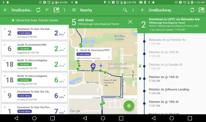
OneBusAway is an open source application that allows you to mark the desired stops and search for the nearest ones, set reminders for frequently used routes. As the name of the app suggests, it only focuses on buses.
Unfortunately, OneBusAway, unlike the applications described above, does not try to cover all types of public transport. The app specializes in buses only and works in a limited area: Oregon, California, Washington (state), Florida, Washington (DC), York province in Canada.
Launch OneBusAway, take a look at the map of the city you want - each green dot represents a bus stop. Tap on the stop - get detailed information on the bus routes passing through it.
Available for Android / iPhone .
Google maps
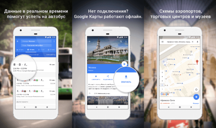
Sometimes you need to go back to basics. If you are already familiar with Google Maps, then you probably know how easy it is to work with this application. It is enough to enter your destination, and the service will immediately select the best route.
If you are interested in public transport, click the train icon at the top of the menu. At the same time, the service will provide information not only on rail transport, but also on bus routes, as well as on the timetable of trams and metro trains.
Available for Android / iPhone .